Skip Navigation Links
NOAA NOAA United States Department of Commerce

NHC Graphical Outlook Archive


« Earliest Available         ‹ Earlier         Later ›         Latest Available »
GIS Shapefiles
Central Pacific Eastern Pacific Atlantic

View 2-Day Graphical Tropical Weather Outlook
Click for Eastern North Pacific Click for Eastern North Pacific

Tropical Weather Outlook Text

ZCZC HFOTWOCP ALL
TTAA00 PHFO DDHHMM

Tropical Weather Outlook
NWS Central Pacific Hurricane Center Honolulu HI
800 PM HST Sat Oct 2 2021

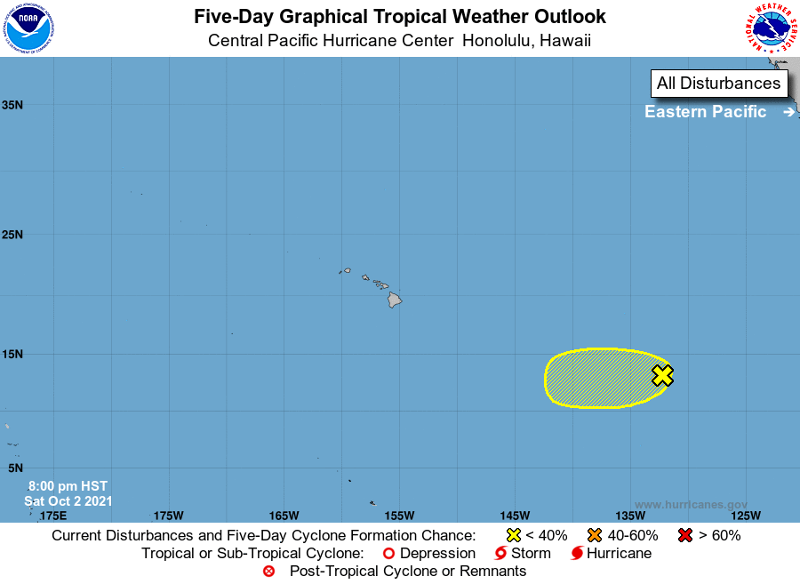
For the central North Pacific...between 140W and 180W:

1. A broad area of low pressure located roughly 1600 miles 
east-southeast of Hilo, Hawaii continues to produce disorganized 
shower and thunderstorm activity. Although additional development is 
not expected over the next couple of days, environmental conditions 
could become a little more conducive for gradual development by 
early next week while the system drifts westward through the middle 
of next week.
* Formation chance through 48 hours...low...near 0 percent.
* Formation chance through 5 days...low...10 percent.

Elsewhere, no tropical cyclones are expected during the next 5 days.

Forecaster Bohlin


List of Atlantic Outlooks (May 2023 - present)
List of East Pacific Outlooks (May 2023 - present)
List of Central Pacific Outlooks (May 2023 - present)
List of Atlantic Outlooks (July 2014 - April 2023)
List of East Pacific Outlooks (July 2014 - April 2023)
List of Central Pacific Outlooks (June 2019 - April 2023)
List of Atlantic Outlooks (June 2009 - June 2014)
List of East Pacific Outlooks (June 2009 - June 2014)