ZCZC MIATWOEP ALL
TTAA00 KNHC DDHHMM
Tropical Weather Outlook
NWS National Hurricane Center Miami FL
1100 AM PDT Fri Oct 1 2021
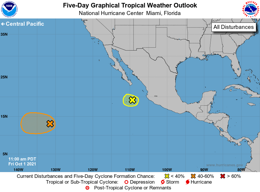
For the eastern North Pacific...east of 140 degrees west longitude:
1. A broad area of low pressure located about 1600 miles west-southwest
of the southern tip of the Baja California peninsula continues to
produce disorganized showers and thunderstorms. Environmental
conditions are expected to be conducive for slow development during
the next several days, and a tropical depression could form over the
weekend or early next week while the system drifts westward.
* Formation chance through 48 hours...low...20 percent.
* Formation chance through 5 days...medium...40 percent.
2. A trough of low pressure is producing a few disorganized showers and
thunderstorms a couple of hundred miles west of Manzanillo, Mexico.
Development of this system has become less likely due to unfavorable
environmental conditions. The system is forecast to move generally
west-northwestward at 5 to 10 mph during the next day or two.
* Formation chance through 48 hours...low...10 percent.
* Formation chance through 5 days...low...10 percent.
Forecaster D. Zelinsky