ZCZC MIATWOEP ALL
TTAA00 KNHC DDHHMM
Tropical Weather Outlook
NWS National Hurricane Center Miami FL
500 AM PDT Wed Sep 29 2021
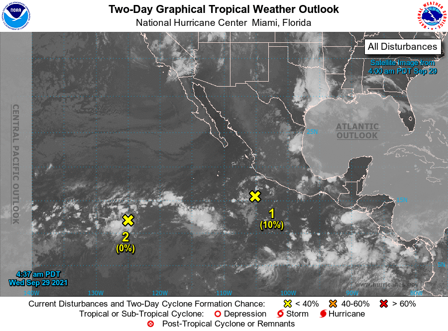
For the eastern North Pacific...east of 140 degrees west longitude:
1. A broad low pressure system located a few hundred miles south of
Manzanillo, Mexico, is producing limited shower activity.
Environmental conditions have become less conducive for development,
and the chances of tropical cyclone formation are decreasing. The
low is forecast to meander off the coast of southwestern Mexico
today, and then move slowly toward the west-northwest at about 5 mph
away from the coast of Mexico on Thursday and Friday.
* Formation chance through 48 hours...low...10 percent.
* Formation chance through 5 days...low...20 percent.
2. A broad area of low pressure has formed several hundred miles
southwest of the southern tip of the Baja California peninsula.
Environmental conditions are expected to be conducive for slow
development during the next several days while the system moves
generally westward at around 10 mph.
* Formation chance through 48 hours...low...near 0 percent.
* Formation chance through 5 days...low...20 percent.
Forecaster Stewart