Skip Navigation Links
NOAA NOAA United States Department of Commerce

NHC Graphical Outlook Archive


« Earliest Available         ‹ Earlier         Later ›         Latest Available »
GIS Shapefiles
Central Pacific Eastern Pacific Atlantic

View 2-Day Graphical Tropical Weather Outlook
Click for Eastern North Pacific Click for Eastern North Pacific

Tropical Weather Outlook Text

ZCZC HFOTWOCP ALL
TTAA00 PHFO DDHHMM

Tropical Weather Outlook
NWS Central Pacific Hurricane Center Honolulu HI
800 AM HST Thu Sep 23 2021

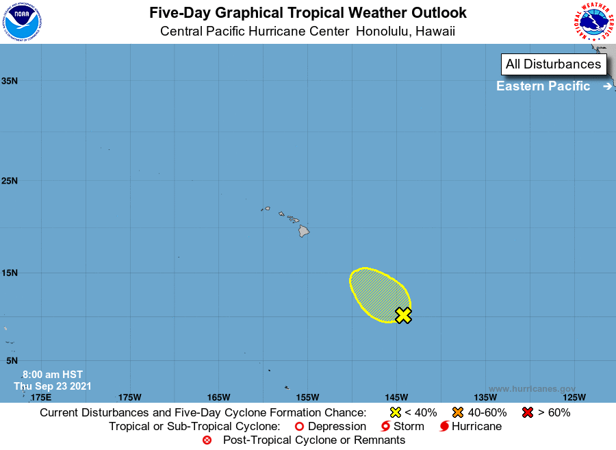
For the central North Pacific...between 140W and 180W:

1. Showers and thunderstorms associated with an elongated area of low 
pressure located about 1000 miles southeast of Hilo, Hawaii have 
recently increased in coverage, but remain disorganized.  
Environmental conditions are only marginally conducive for 
development over the next day or two as the low moves toward the 
northwest at 10 mph. Conditions will become even less favorable 
for development over the weekend.
* Formation chance through 48 hours...low...10 percent
* Formation chance through 5 days...low...10 percent

Elsewhere, no tropical cyclones are expected during the next 5 days.

Forecaster Birchard


List of Atlantic Outlooks (May 2023 - present)
List of East Pacific Outlooks (May 2023 - present)
List of Central Pacific Outlooks (May 2023 - present)
List of Atlantic Outlooks (July 2014 - April 2023)
List of East Pacific Outlooks (July 2014 - April 2023)
List of Central Pacific Outlooks (June 2019 - April 2023)
List of Atlantic Outlooks (June 2009 - June 2014)
List of East Pacific Outlooks (June 2009 - June 2014)