ZCZC MIATWOAT ALL
TTAA00 KNHC DDHHMM
Tropical Weather Outlook
NWS National Hurricane Center Miami FL
200 AM EDT Fri Sep 10 2021
For the North Atlantic...Caribbean Sea and the Gulf of Mexico:
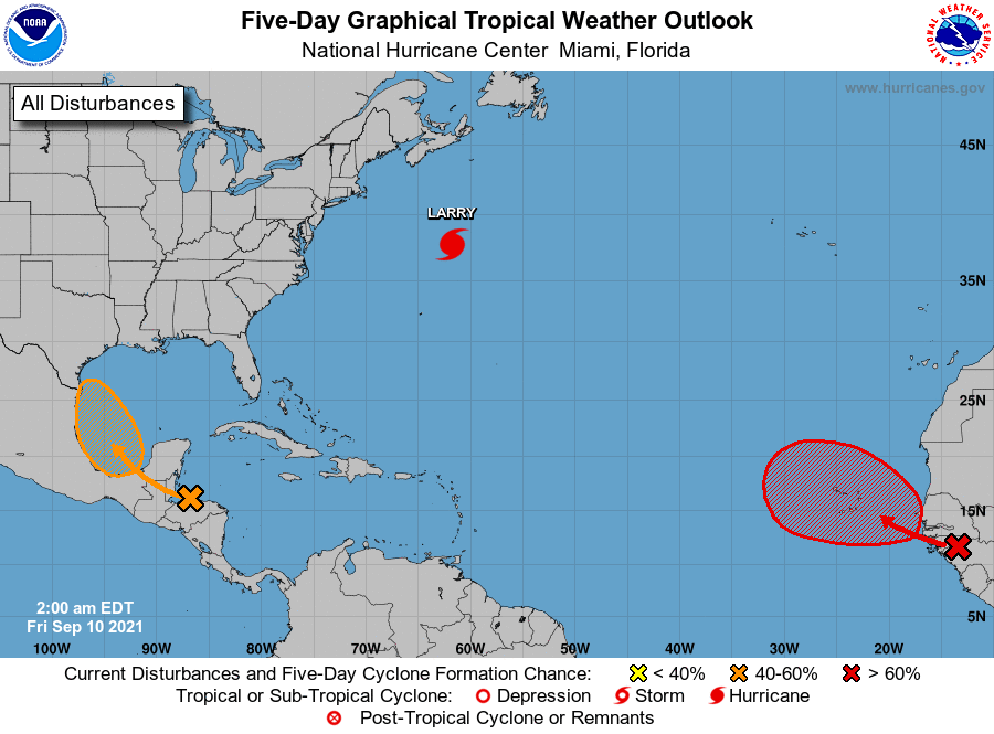
The National Hurricane Center is issuing advisories on Hurricane
Larry, located over the western Atlantic a few hundred miles
north-northeast of Bermuda, and has issued the last advisory on
Post-Tropical Cyclone Mindy, located a few hundred miles east of
Charleston, South Carolina.
1. The northern portion of a tropical wave is producing disorganized
showers and thunderstorms over Honduras, the western Caribbean Sea,
and portions of the Yucatan peninsula. This system is forecast to
move into the Bay of Campeche and merge with a pre-existing surface
trough located over the southwestern Gulf of Mexico by this weekend.
Environmental conditions are expected to be conducive to support
gradual development, and a tropical depression could form Sunday or
Monday before the system moves onshore along the western Gulf of
Mexico coast.
* Formation chance through 48 hours...low...30 percent.
* Formation chance through 5 days...medium...60 percent.
2. A strong tropical wave is expected to emerge off of the west coast
of Africa later today or tonight. Environmental conditions are
forecast to be conducive for development thereafter, and a tropical
depression is likely to form by early next week as the system moves
west-northwestward over the far eastern Atlantic near the Cabo Verde
Islands. Interests in the Cabo Verde Islands should monitor the
progress of this system.
* Formation chance through 48 hours...medium...50 percent.
* Formation chance through 5 days...high...70 percent.
Forecaster Brown