ZCZC MIATWOEP ALL
TTAA00 KNHC DDHHMM
Tropical Weather Outlook
NWS National Hurricane Center Miami FL
1100 AM PDT Sun Sep 5 2021
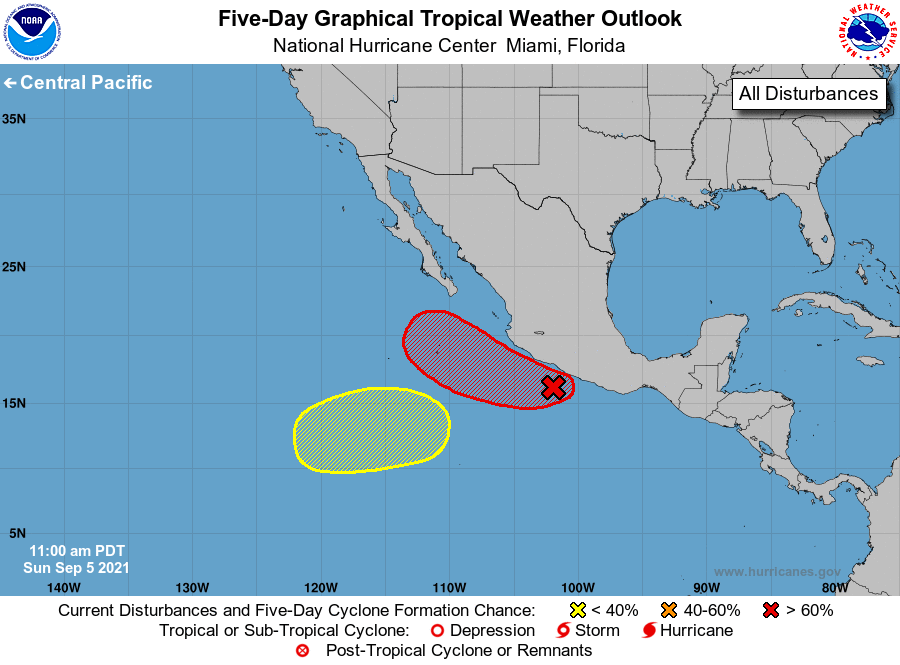
For the eastern North Pacific...east of 140 degrees west longitude:
1. A broad area of low pressure is producing disorganized showers and
thunderstorms within a few hundred miles of the coast of
southwestern Mexico. Environmental conditions are conducive for
gradual development of this system, and a tropical depression is
likely to form by midweek while it moves west-northwestward or
northwestward at 5 to 10 mph just offshore of the coast of Mexico.
* Formation chance through 48 hours...low...30 percent.
* Formation chance through 5 days...high...80 percent.
2. Another area of low pressure is forecast to form in a few days
well to the southwest of the southern tip of the Baja California
peninsula. Some slow development is possible thereafter while the
system meanders over the open eastern Pacific Ocean.
* Formation chance through 48 hours...low...near 0 percent.
* Formation chance through 5 days...low...30 percent.
Forecaster Latto