ZCZC MIATWOAT ALL
TTAA00 KNHC DDHHMM
Tropical Weather Outlook
NWS National Hurricane Center Miami FL
800 PM EDT Fri Sep 3 2021
For the North Atlantic...Caribbean Sea and the Gulf of Mexico:
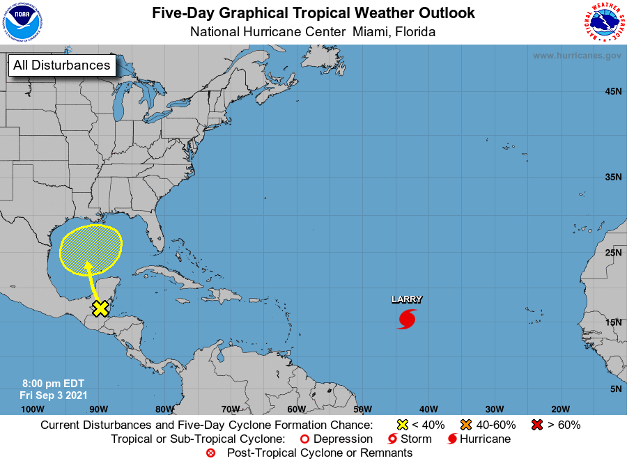
The National Hurricane Center is issuing advisories on Hurricane
Larry, located over the central tropical Atlantic about midway
between the Cabo Verde Islands and the Lesser Antilles.
1. A surface trough over portions of Central America and the
southern Yucatan Peninsula of Mexico is producing disorganized
shower and thunderstorm activity. This system is expected to move
northwestward during the next day or so, bringing locally heavy
rains to these areas. The disturbance is expected to move over the
southwestern or south-central Gulf of Mexico late this weekend, and
then move generally northward over the western or central Gulf of
Mexico early next week. Unfavorable upper-level winds are expected
to limit development through Monday, but environmental conditions
could become marginally favorable for some gradual development by
Tuesday or Wednesday.
* Formation chance through 48 hours...low...near 0 percent.
* Formation chance through 5 days...low...30 percent.
Forecaster Brown