ZCZC MIATWOEP ALL
TTAA00 KNHC DDHHMM
Tropical Weather Outlook
NWS National Hurricane Center Miami FL
500 AM PDT Wed Aug 25 2021
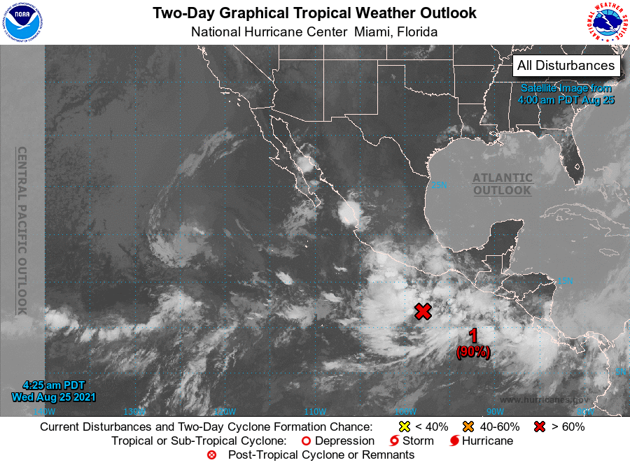
For the eastern North Pacific...east of 140 degrees west longitude:
1. A broad area of low pressure located a few hundred miles south of
the southern coast of Mexico continues to produce disorganized
shower and thunderstorm activity. Upper-level winds are forecast
to become more conducive for development of this system, and a
tropical depression is expected to form during the next day or so
while moving toward the west-northwest at about 10 mph, offshore of
the coast of southwestern Mexico. Additional information on this
system, including gale warnings, can be found in High Seas Forecasts
issued by the National Weather Service.
* Formation chance through 48 hours...high...90 percent.
* Formation chance through 5 days...high...90 percent.
High Seas Forecasts issued by the National Weather Service
can be found under AWIPS header NFDHSFEPI, WMO header FZPN02
KWBC, and on the web at ocean.weather.gov/shtml/NFDHSFEPI.php
Forecaster Berg