ZCZC MIATWOEP ALL
TTAA00 KNHC DDHHMM
Tropical Weather Outlook
NWS National Hurricane Center Miami FL
500 PM PDT Sun Aug 22 2021
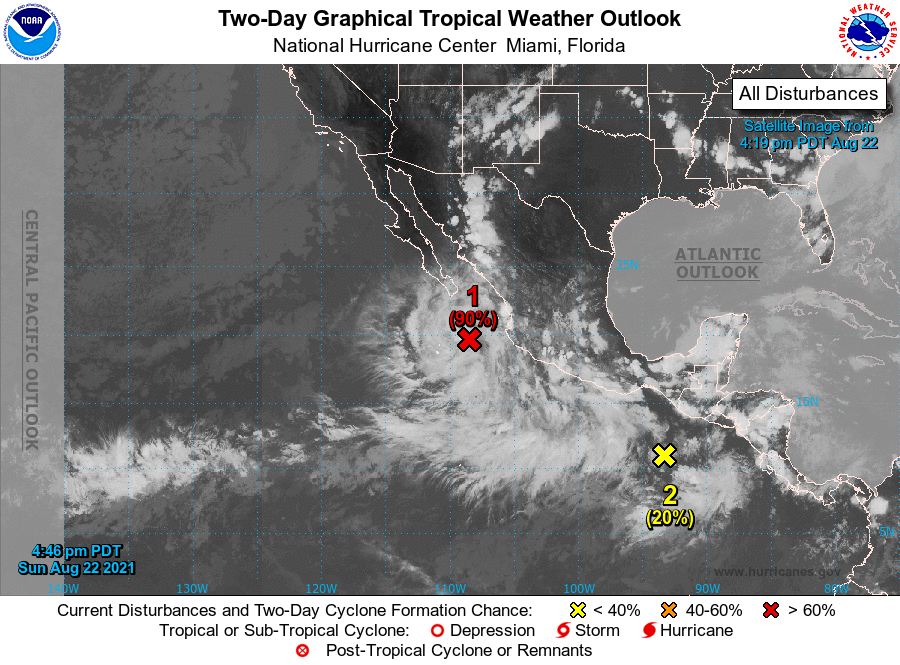
For the eastern North Pacific...east of 140 degrees west longitude:
1. Showers and a few thunderstorms continue to show signs of
organization in association with an area of low pressure located a
couple of hundred miles south-southeast of the southern tip of the
Baja California peninsula. Environmental conditions remain
conducive for further development, and a tropical depression is
likely to form tonight or on Monday while the system moves westward
at 10 to 15 mph, away from the coast of Mexico. Additional
information on this system can found in high seas forecasts issued
by the NOAA National Weather Service.
* Formation chance through 48 hours...high...90 percent.
* Formation chance through 5 days...high...90 percent.
2. An area of disturbed weather off the coast of southern Mexico is
associated with some disorganized shower activity. Environmental
conditions are forecast to be favorable for some gradual development
of this system, and a tropical depression is likely to form by late
this week offshore of the southwestern coast of Mexico while the
system move west-northwestward or northwestward at around 10 mph.
* Formation chance through 48 hours...low...20 percent.
* Formation chance through 5 days...high...70 percent.
High Seas Forecasts issued by the National Weather Service
can be found under AWIPS header NFDHSFEPI, WMO header FZPN02
KWBC, and on the web at ocean.weather.gov/shtml/NFDHSFEPI.php
Forecaster Reinhart/Pasch