ZCZC MIATWOEP ALL
TTAA00 KNHC DDHHMM
Tropical Weather Outlook
NWS National Hurricane Center Miami FL
500 AM PDT Sat Aug 7 2021
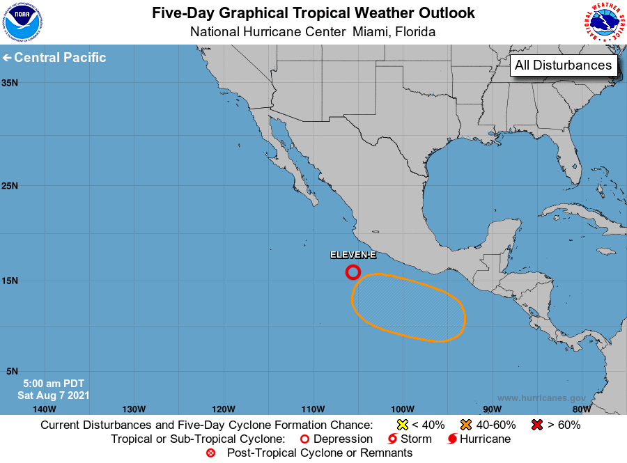
For the eastern North Pacific...east of 140 degrees west longitude:
1. The latest satellite derived wind data indicated that the low
pressure system located a few hundred miles south of Manzanillo,
Mexico, has become better defined overnight. Showers and
thunderstorms associated with the system continue to show signs of
organization. Environmental conditions are conducive for
additional development, and a tropical depression is expected to
form today or Sunday while it moves westward or west-northwestward
at 5 to 10 mph.
* Formation chance through 48 hours...medium...80 percent.
* Formation chance through 5 days...high...90 percent.
2. An area of low pressure is expected to develop a few hundred miles
south of the Gulf of Tehuantepec by early next week. Environmental
conditions are forecast to be conducive for gradual development
thereafter, and a tropical depression could form by the middle of
next week while the system moves west-northwestward at about 10
mph, parallel to and offshore of the coast of southern Mexico.
* Formation chance through 48 hours...low...near 0 percent.
* Formation chance through 5 days...medium...50 percent.
Forecaster Roberts