ZCZC MIATWOEP ALL
TTAA00 KNHC DDHHMM
Tropical Weather Outlook
NWS National Hurricane Center Miami FL
500 PM PDT Thu Jun 24 2021
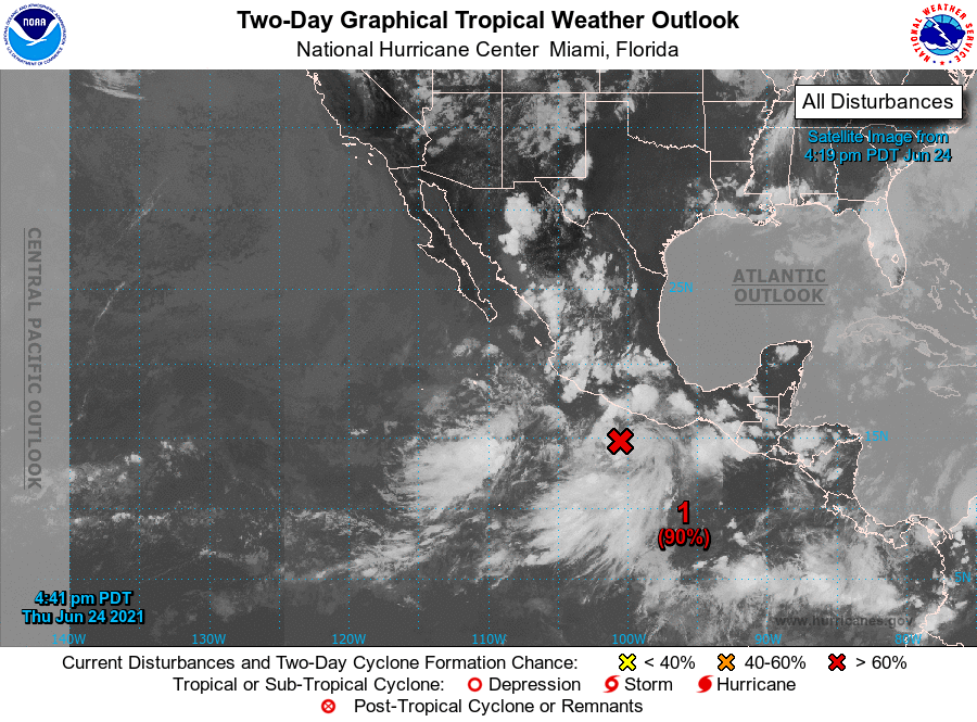
For the eastern North Pacific...east of 140 degrees west longitude:
1. Showers and thunderstorms continue to show signs of organization in
association with a low pressure system located about 150 miles
south-southwest of Acapulco, Mexico. However, the low's surface
circulation still appears broad without a well-defined center.
Environmental conditions are conducive for additional development,
and a tropical depression or tropical storm is expected to form in a
day or so while moving slowly west-northwestward at 5 to 10 mph.
This system is expected to be near the coast of southwestern Mexico
through early next week, and interests there should monitor its
potential for development, as well as the threat of heavy rainfall
and flooding. For additional information on this system, please
refer to High Seas Forecasts issued by the National Weather Service.
* Formation chance through 48 hours...high...90 percent.
* Formation chance through 5 days...high...90 percent.
High Seas Forecasts issued by the National Weather Service can be
found under AWIPS header NFDHSFEPI, WMO header FZPN02 KWBC, and on
the web at ocean.weather.gov/shtml/NFDHSFEPI.php
Forecaster Berg