ZCZC MIATWOEP ALL
TTAA00 KNHC DDHHMM
Tropical Weather Outlook
NWS National Hurricane Center Miami FL
1100 PM PDT Thu Jun 10 2021
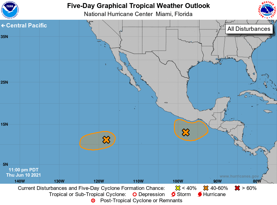
For the eastern North Pacific...east of 140 degrees west longitude:
1. A broad area of low pressure has developed a couple hundred miles
south-southwest of Puerto Angel, Mexico. Although shower and
thunderstorm activity has changed little in organization this
evening, environmental conditions appear conducive for additional
development, and a tropical depression could form by this weekend
while the system drifts north-northeastward. Heavy rainfall will be
possible over portions of Central America and southern Mexico
through early next week. See products from your local meteorological
service for more information.
* Formation chance through 48 hours...low...30 percent.
* Formation chance through 5 days...medium...50 percent.
2. A broad area of low pressure located about 1000 miles southwest of
the southern tip of the Baja California peninsula continues to
produce disorganized showers and thunderstorms. Environmental
conditions appear marginally conducive for some gradual development
over the next few days, and a tropical depression could form by
early next week while the system moves slowly westward.
* Formation chance through 48 hours...low...20 percent.
* Formation chance through 5 days...medium...40 percent.
Forecaster Papin/Stewart