ZCZC MIATWOEP ALL
TTAA00 KNHC DDHHMM
Tropical Weather Outlook
NWS National Hurricane Center Miami FL
500 PM PDT Sun Jun 6 2021
For the eastern North Pacific...east of 140 degrees west longitude:
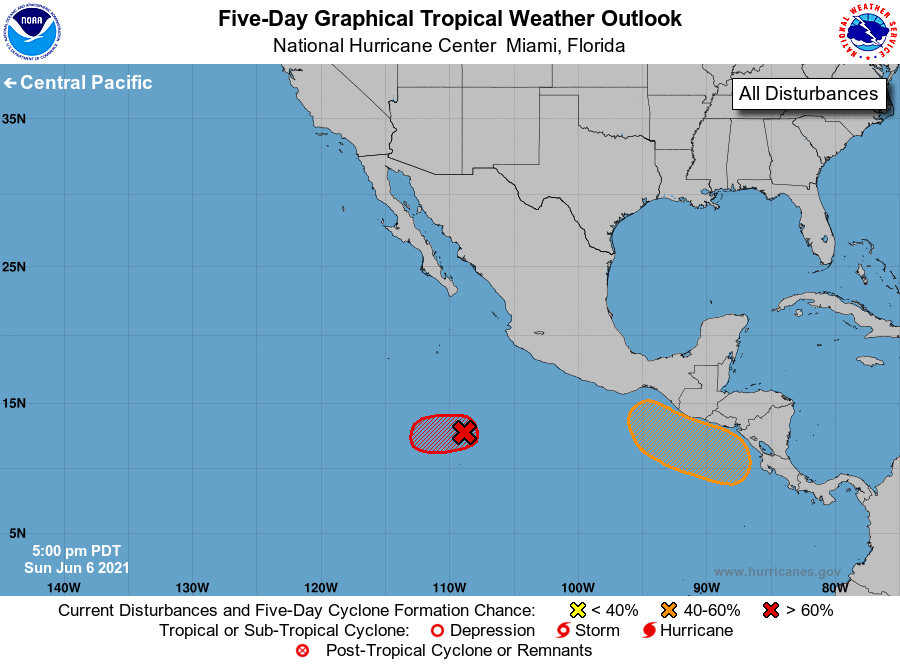
1. Showers and thunderstorms continue in association with an area of
low pressure located about 500 miles south-southwest of Manzanillo,
Mexico. However, the circulation of the system remains broad and
elongated and it still lacks a well-defined center. Development of
this system into a short-lived tropical depression is still likely
before environmental conditions become less favorable by late
Monday. The low pressure area is expected to move slowly westward
well south of Mexico during the next few days.
* Formation chance through 48 hours...high...80 percent.
* Formation chance through 5 days...high...80 percent.
2. A broad trough of low pressure is expected to form a couple of
hundred miles south of the coasts of southern Mexico, El Salvador,
and Guatemala in a day or two. Environmental conditions appear
favorable for some development, and a tropical depression could
develop by the end of the week as the system moves slowly
northwestward or northward.
* Formation chance through 48 hours...low...near 0 percent.
* Formation chance through 5 days...medium...40 percent.
Forecaster Cangialosi