ZCZC MIATWOAT ALL
TTAA00 KNHC DDHHMM
Tropical Weather Outlook
NWS National Hurricane Center Miami FL
100 PM EST Thu Nov 26 2020
For the North Atlantic...Caribbean Sea and the Gulf of Mexico:
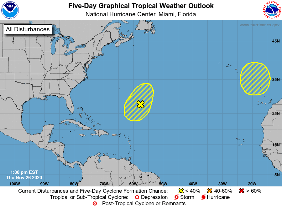
1. Shower activity associated with a frontal low pressure system
located several hundred miles southeast of Bermuda has become a
little better organized today. The low could acquire some
subtropical characteristics during the next day or two while it
drifts south-southwestward. After that time, the system is expected
to move north-northeastward into an area of less favorable
environmental conditions.
* Formation chance through 48 hours...low...30 percent.
* Formation chance through 5 days...low...30 percent.
2. A non-tropical area of low pressure is expected to form over the far
eastern Atlantic during the weekend. This system could gradually
gain subtropical characteristics while it moves slowly southward
through early next week.
* Formation chance through 48 hours...low...near 0 percent.
* Formation chance through 5 days...low...20 percent.
Forecaster Beven