ZCZC MIATWOAT ALL
TTAA00 KNHC DDHHMM
Tropical Weather Outlook
NWS National Hurricane Center Miami FL
700 PM EST Sun Nov 22 2020
For the North Atlantic...Caribbean Sea and the Gulf of Mexico:
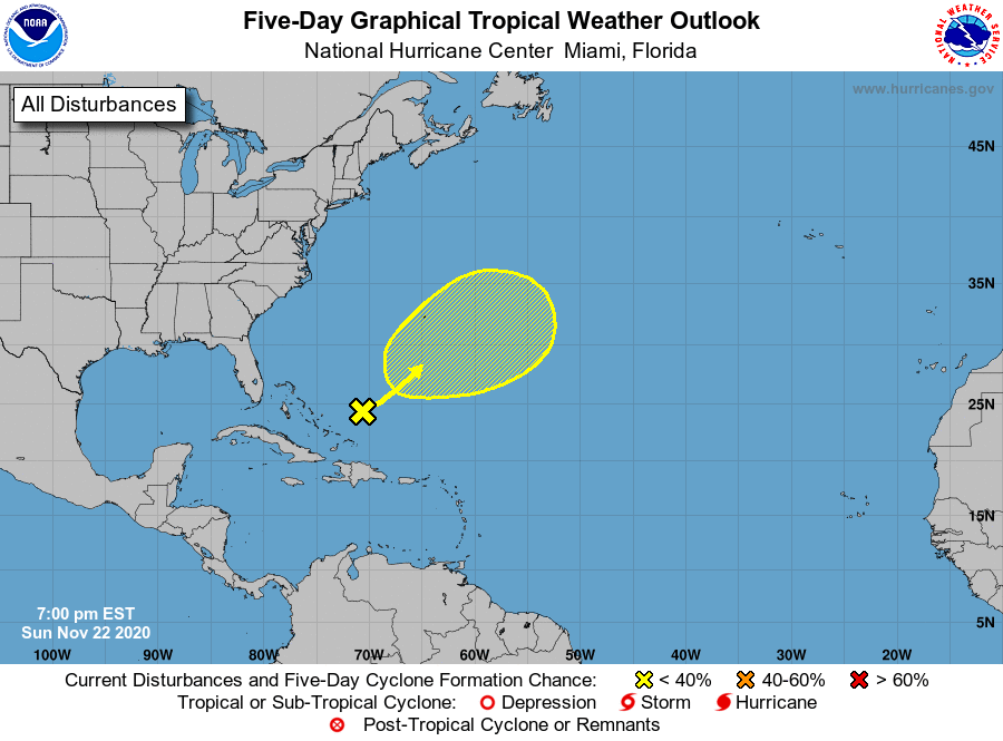
1. A non-tropical area of low pressure has formed a couple of hundred
miles east of the southeastern Bahamas. The associated shower and
thunderstorm activity remains disorganized and extends over a broad
area mainly to the east of the low. There is a slight chance that
the system could acquire some subtropical characteristics as it
moves northeastward over the next day or so. However, on Tuesday
the disturbance is expected to merge with a cold front. Later in
the week, this system may have a second opportunity to develop
subtropical characteristics if it becomes separated from the front
and meanders over the central Atlantic.
* Formation chance through 48 hours...low...10 percent.
* Formation chance through 5 days...low...20 percent.
Forecaster Latto