ZCZC MIATWOAT ALL
TTAA00 KNHC DDHHMM
Tropical Weather Outlook
NWS National Hurricane Center Miami FL
100 PM EST Wed Nov 18 2020
For the North Atlantic...Caribbean Sea and the Gulf of Mexico:
The National Hurricane Center has issued the last advisory on the
remnants of Iota, located inland over El Salvador.
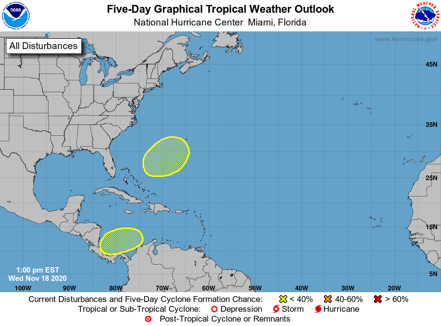
1. A broad area of low pressure could form in a day or so over the
southwestern Caribbean Sea. Development, if any, of this system is
expected to slow to occur during the next several days while the
it moves slowly west-southwestward or westward across the
southwestern Caribbean Sea. Regardless of tropical cyclone
formation, areas of heavy rain are possible during the next several
days from Nicaragua southward across Central America and into
Colombia. These rains could cause new flooding concerns, especially
across previously inundated areas.
* Formation chance through 48 hours...low...near 0 percent.
* Formation chance through 5 days...low...10 percent.
2. A non-tropical area of low pressure could form between the Bahamas
and Bermuda by early next week. The system could gradually develop
subtropical characteristics through the middle of next week while it
moves northeastward.
* Formation chance through 48 hours...low...near 0 percent.
* Formation chance through 5 days...low...20 percent.
Forecaster Blake