ZCZC MIATWOAT ALL
TTAA00 KNHC DDHHMM
Tropical Weather Outlook
NWS National Hurricane Center Miami FL
100 PM EST Tue Nov 17 2020
For the North Atlantic...Caribbean Sea and the Gulf of Mexico:
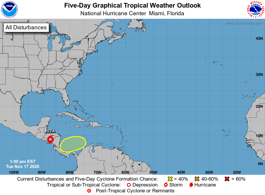
The National Hurricane Center is issuing advisories on Tropical
Storm Iota, located inland over Nicaragua.
1. A broad area of low pressure could form in a day or so over the
southwestern Caribbean Sea. Environmental conditions do not
appear to be as conducive for development as once thought, but slow
development is possible over the next several days while the system
moves slowly westward or west-southwestward across the southwestern
Caribbean Sea. Regardless of tropical cyclone formation, areas of
heavy rain are possible during the next several days from Nicaragua
southward across Central America and into Colombia. These rains
could cause new flooding concerns, especially across previously
inundated areas.
* Formation chance through 48 hours...low...near 0 percent.
* Formation chance through 5 days...low...30 percent.
Forecaster Blake