ZCZC MIATWOAT ALL
TTAA00 KNHC DDHHMM
Tropical Weather Outlook
NWS National Hurricane Center Miami FL
200 PM EDT Wed Oct 21 2020
For the North Atlantic...Caribbean Sea and the Gulf of Mexico:
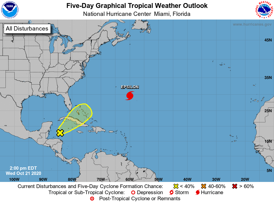
The National Hurricane Center is issuing advisories on Hurricane
Epsilon, located over the central Atlantic a few hundred miles
east-southeast of Bermuda.
1. A trough of low pressure extending from the southwestern to the
northwestern Caribbean Sea is producing a large area of disorganized
showers and thunderstorms. Any development of this system is
expected to be slow over the next several days as the system passes
near western or central Cuba, the Florida Straits, and the Bahamas.
Regardless of development, locally heavy rainfall is possible in
those areas and South Florida at times through the weekend.
* Formation chance through 48 hours...low...near 0 percent.
* Formation chance through 5 days...low...20 percent.
Forecaster Reinhart/Blake