ZCZC MIATWOAT ALL
TTAA00 KNHC DDHHMM
Tropical Weather Outlook
NWS National Hurricane Center Miami FL
800 AM EDT Fri Oct 16 2020
For the North Atlantic...Caribbean Sea and the Gulf of Mexico:
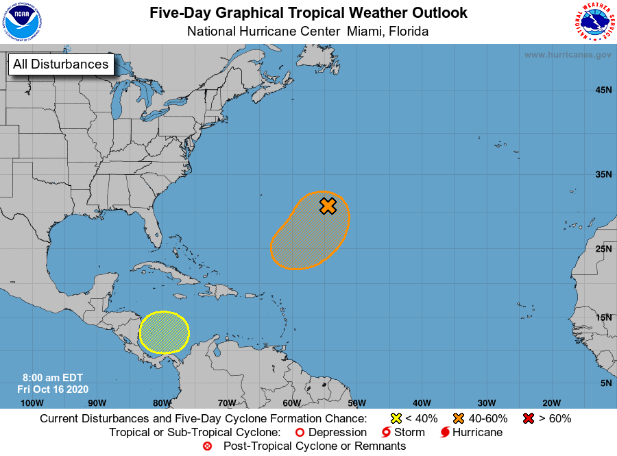
1. Shower activity associated with a broad non-tropical low pressure
system located about 600 miles east-southeast of Bermuda has
become a little better organized this morning. Additional gradual
tropical or subtropical development of this system is possible
through the middle of next week while the low meanders over the
central Atlantic well to the southeast of Bermuda.
* Formation chance through 48 hours...low...20 percent.
* Formation chance through 5 days...medium...40 percent.
2. A broad area of low pressure is expected to form early next week
over the southwestern Caribbean Sea. Some gradual development of
this system will be possible through the middle of next week while
it remains nearly stationary over the southwestern Caribbean Sea.
* Formation chance through 48 hours...low...near 0 percent.
* Formation chance through 5 days...low...30 percent.
Forecaster Beven