ZCZC MIATWOAT ALL
TTAA00 KNHC DDHHMM
Tropical Weather Outlook
NWS National Hurricane Center Miami FL
800 PM EDT Tue Oct 13 2020
For the North Atlantic...Caribbean Sea and the Gulf of Mexico:
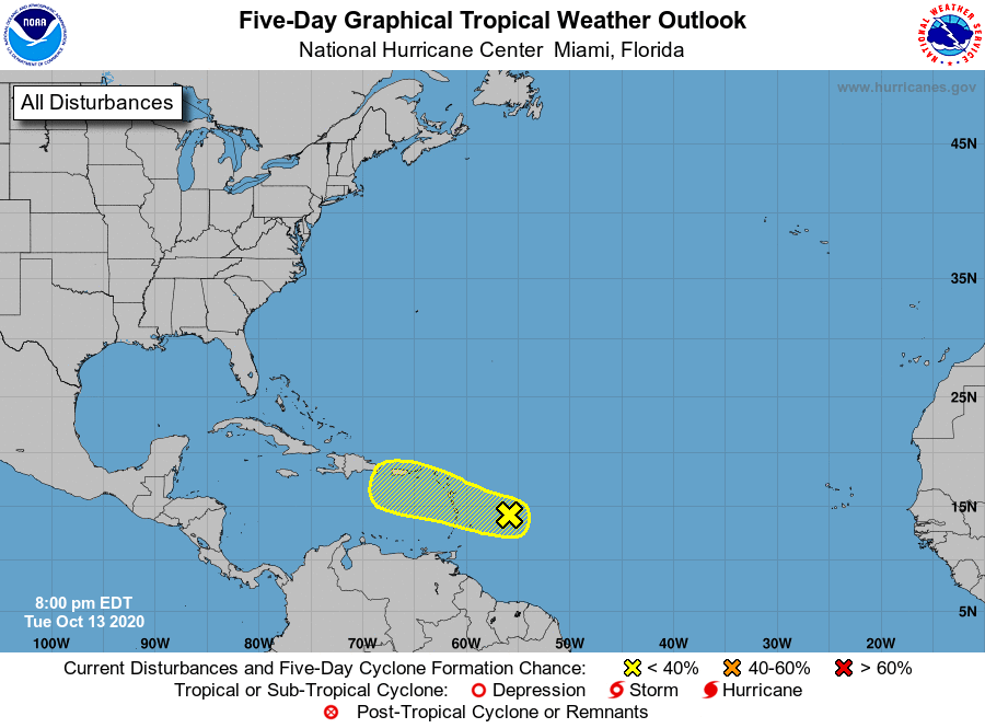
1. A broad area of low pressure associated with a tropical wave is
located about 350 miles east of the Windward Islands. Although this
disturbance continues to produce a large area of disorganized
showers and thunderstorms, mainly to the east of the center, strong
upper-level winds are expected to inhibit development for the next
few days. However, the system will move west-northwestward through
the end of the week, and produce locally heavy rainfall and strong
gusty winds across the central and northern Lesser Antilles on
Wednesday, the Virgin Islands and Puerto Rico on Thursday, and
Hispaniola on Friday.
* Formation chance through 48 hours...low...20 percent.
* Formation chance through 5 days...low...20 percent.
Forecaster Stewart