ZCZC MIATWOAT ALL
TTAA00 KNHC DDHHMM
Tropical Weather Outlook
NWS National Hurricane Center Miami FL
200 PM EDT Mon Oct 12 2020
For the North Atlantic...Caribbean Sea and the Gulf of Mexico:
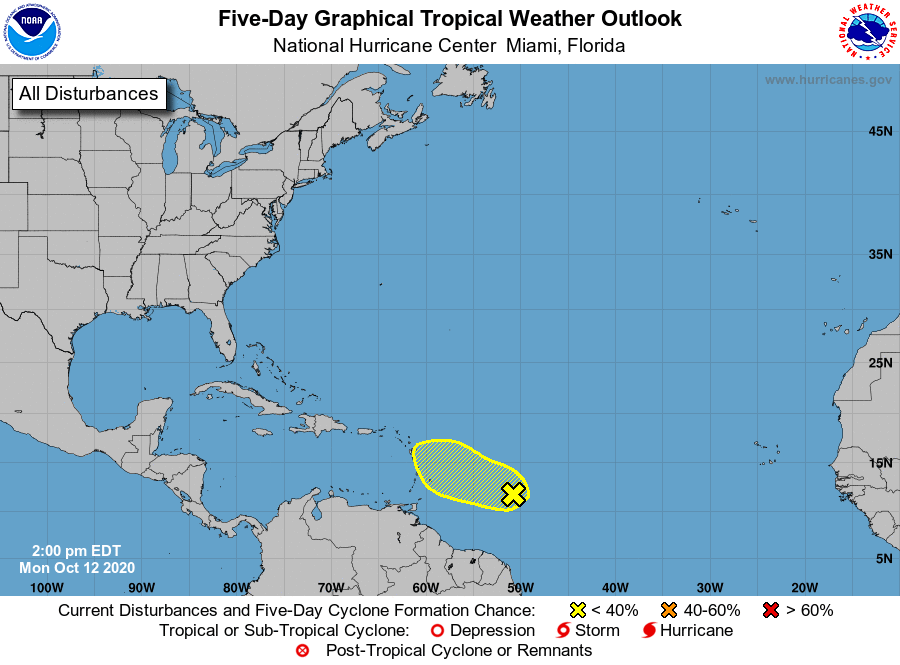
1. Recently-received satellite wind data indicates that the
circulation associated with a tropical wave located about
700 miles east of the Windward Islands has become better
defined. However, upper-level wind have become less
conducive for development. Some slow development of this
system may occur during the next day or so while it moves generally
west-northwestward near 15 mph. After that time, the upper-level
winds will become even less conducive for development.
* Formation chance through 48 hours...low...30 percent.
* Formation chance through 5 days...low...30 percent.
Forecaster Beven