ZCZC MIATWOEP ALL
TTAA00 KNHC DDHHMM
Tropical Weather Outlook
NWS National Hurricane Center Miami FL
500 AM PDT Sun Oct 11 2020
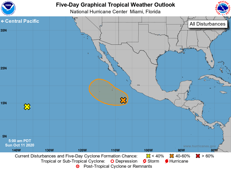
For the eastern North Pacific...east of 140 degrees west longitude:
1. A small area of low pressure is located over the far southwestern
portion of eastern Pacific about 1900 miles west-southwest of the
southern tip of the Baja California peninsula. While thunderstorm
activity has recently increased with the low, environmental
conditions are not expected to be conducive for further
development. The low will likely continue moving westward around 15
mph for the next few days.
* Formation chance through 48 hours...low...near 0 percent.
* Formation chance through 5 days...low...near 0 percent.
2. Showers and thunderstorms have become more concentrated a few
hundred miles southwest of the coast of southwestern Mexico, and
are partially associated with the remnants of Norbert. Upper-level
winds could gradually become more conducive for development during
the next few days while the system moves slowly to the
west-northwest or northwest.
* Formation chance through 48 hours...low...20 percent.
* Formation chance through 5 days...medium...40 percent.
Forecaster Blake