ZCZC MIATWOEP ALL
TTAA00 KNHC DDHHMM
Tropical Weather Outlook
NWS National Hurricane Center Miami FL
500 PM PDT Tue Oct 6 2020
For the eastern North Pacific...east of 140 degrees west longitude:
The National Hurricane Center is issuing advisories on Tropical
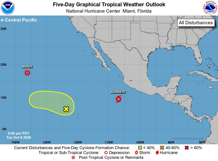
Storm Marie, located more than 1600 miles west of the southern tip
of the Baja California peninsula, and on Tropical Storm Norbert,
located several hundred miles southwest of the southwestern coast of
Mexico.
1. An elongated area of low pressure, located more than 1000 miles
southwest of the southern tip of the Baja California peninsula, is
producing disorganized showers and thunderstorms. Some development
of this system is possible during the next few days while it moves
slowly north-northwestward at about 5 mph.
* Formation chance through 48 hours...low...20 percent.
* Formation chance through 5 days...low...30 percent.
Forecaster Berg