ZCZC MIATWOAT ALL
TTAA00 KNHC DDHHMM
Tropical Weather Outlook
NWS National Hurricane Center Miami FL
800 PM EDT Sun Sep 20 2020
For the North Atlantic...Caribbean Sea and the Gulf of Mexico:
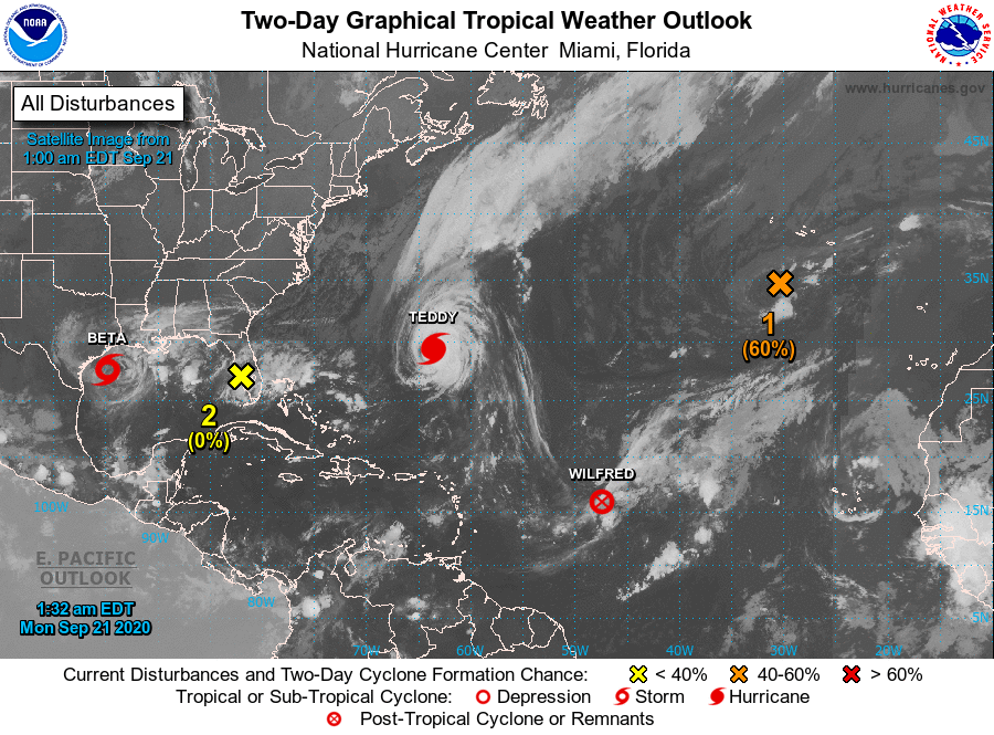
The National Hurricane Center is issuing advisories on Tropical
Storm Beta, located over the western Gulf of Mexico, on Hurricane
Teddy, located a couple of hundred miles south-southeast of
Bermuda, and on Tropical Depression Wilfred, located over the
central tropical Atlantic.
1. Post-Tropical Cyclone Paulette is located a few hundred miles south
of the Azores and continues to produce disorganized shower activity.
This system is drifting southward over marginally warm waters and is
expected to begin moving eastward on Monday. The cyclone could
develop tropical or subtropical characteristics during the next
day or two. For more information about marine hazards associated
with this system, see High Seas Forecasts issued by Meteo France.
* Formation chance through 48 hours...medium...60 percent.
* Formation chance through 5 days...medium...60 percent.
2. A weak area of low pressure located inland over southwestern
Florida is producing disorganized showers and thunderstorms over
portions of the Florida peninsula. The low is forecast to move
west-southwestward at about 10 mph over the southeastern Gulf of
Mexico later tonight and Monday. Environmental conditions are not
expected to be conducive, and significant development of this
system is not anticipated.
* Formation chance through 48 hours...low...near 0 percent.
* Formation chance through 5 days...low...near 0 percent.
High Seas Forecasts issued by Meteo France can be found under WMO
header FQNT50 LFPW and are available on the web at
www.meteofrance.com/previsions-meteo-marine/bulletin/grandlarge/
metarea2
Forecaster Brown