ZCZC MIATWOEP ALL
TTAA00 KNHC DDHHMM
Tropical Weather Outlook
NWS National Hurricane Center Miami FL
1100 AM PDT Sun Sep 20 2020
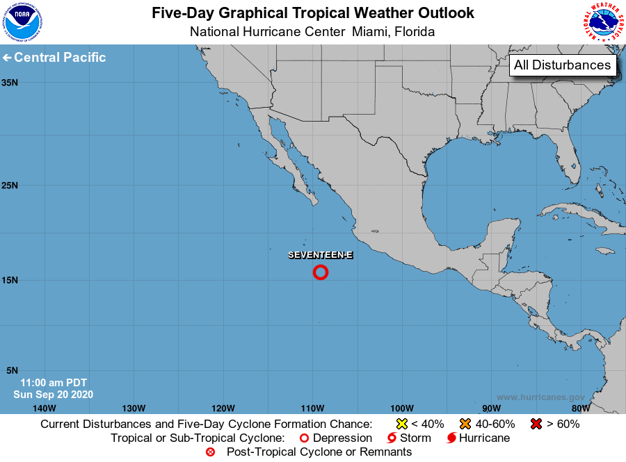
For the eastern North Pacific...east of 140 degrees west longitude:
1. Satellite images indicate that the circulation associated with the
low pressure system centered about 350 miles southwest of
Manzanillo, Mexico, has become better defined today, with
thunderstorm activity still showing signs of organization. If this
trend continues, advisories could be initiated on a tropical
depression later today or tonight, and environmental conditions are
forecast to be conducive for additional development while the system
moves west-northwestward at about 10 mph.
* Formation chance through 48 hours...high...near 100 percent.
* Formation chance through 5 days...high...near 100 percent.
Forecaster Blake