Skip Navigation Links
NOAA NOAA United States Department of Commerce

NHC Graphical Outlook Archive


« Earliest Available         ‹ Earlier         Later ›         Latest Available »
GIS Shapefiles
Central Pacific Eastern Pacific Atlantic

View 2-Day Graphical Tropical Weather Outlook
Click for Atlantic Click for Atlantic

Tropical Weather Outlook Text

ZCZC MIATWOEP ALL
TTAA00 KNHC DDHHMM

Tropical Weather Outlook
NWS National Hurricane Center Miami FL
1100 AM PDT Tue Sep 8 2020

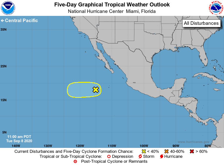
For the eastern North Pacific...east of 140 degrees west longitude:

1. An elongated area of low pressure located about 450 miles 
southwest of the southern tip of the Baja California peninsula is 
producing disorganized showers and a few thunderstorms. 
Environmental conditions are marginally conducive for some 
development of this system during the next several days while it 
moves slowly westward. 
* Formation chance through 48 hours...low...10 percent.
* Formation chance through 5 days...low...20 percent.

Forecaster Cangialosi


List of Atlantic Outlooks (May 2023 - present)
List of East Pacific Outlooks (May 2023 - present)
List of Central Pacific Outlooks (May 2023 - present)
List of Atlantic Outlooks (July 2014 - April 2023)
List of East Pacific Outlooks (July 2014 - April 2023)
List of Central Pacific Outlooks (June 2019 - April 2023)
List of Atlantic Outlooks (June 2009 - June 2014)
List of East Pacific Outlooks (June 2009 - June 2014)