ZCZC MIATWOAT ALL
TTAA00 KNHC DDHHMM
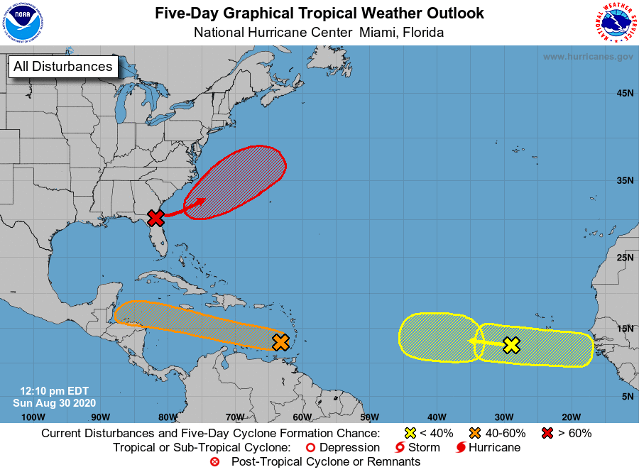
Special Tropical Weather Outlook
NWS National Hurricane Center Miami FL
1210 PM EDT Sun Aug 30 2020
For the North Atlantic...Caribbean Sea and the Gulf of Mexico:
Special Tropical Weather Outlook issued to update the discussion on
the system over the eastern Caribbean Sea in the first paragraph.
1. UPDATED: Showers and thunderstorms associated with a tropical wave
over the eastern Caribbean Sea are beginning to show signs of
organization. Recent satellite-derived surface winds also indicated
that a broad low pressure system has formed in association with the
wave. Additional development of this disturbance is expected over
the next few days, and a tropical depression could form during the
next couple of days while the system moves moves westward at about
15 mph across the Caribbean Sea. Interests in Jamaica, Honduras,
Belize, Guatemala and Yucatan should monitor the progress of this
disturbance.
* Formation chance through 48 hours...medium...50 percent.
* Formation chance through 5 days...medium...60 percent.
2. A westward-moving tropical wave is located over the eastern Atlantic
Ocean, several hundred miles southwest of the Cabo Verde Islands.
This system is producing limited shower activity, and any further
development is expected to be slow to occur while it moves slowly
westward over the eastern or central tropical Atlantic.
* Formation chance through 48 hours...low...near 0 percent.
* Formation chance through 5 days...low...30 percent.
3. An area of low pressure is expected to form off the southeastern
coast of the United States in a day or two. Subsequent development
of this system is possible, and a tropical depression is likely to
form by the middle of the week while the system moves northeastward
or east-northeastward, initially parallel to the southeastern coast
of the U.S. and then away from land.
* Formation chance through 48 hours...medium...50 percent.
* Formation chance through 5 days...high...70 percent.
4. A new tropical wave is expected to emerge off the coast of Africa
in a couple of days. Some gradual development of this system will
be possible through the end of the week while it moves slowly
westward over the far eastern tropical Atlantic Ocean.
* Formation chance through 48 hours...low...near 0 percent.
* Formation chance through 5 days...low...20 percent.
Forecaster Stewart