Skip Navigation Links
NOAA NOAA United States Department of Commerce

NHC Graphical Outlook Archive


« Earliest Available         ‹ Earlier         Later ›         Latest Available »
GIS Shapefiles
Central Pacific Eastern Pacific Atlantic

View 2-Day Graphical Tropical Weather Outlook
Click for Eastern North Pacific Click for Eastern North Pacific

Tropical Weather Outlook Text

ZCZC HFOTWOCP ALL
TTAA00 PHFO DDHHMM

Tropical Weather Outlook
NWS Central Pacific Hurricane Center Honolulu HI
200 PM HST Fri Aug 21 2020

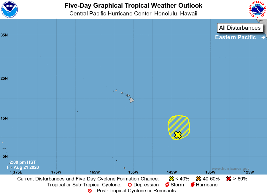
For the central North Pacific...between 140W and 180W:

1. An area of low pressure that was once the remnants of TD 10E 
is located around 1025 miles southeast of Hilo, Hawaii, and is 
producing showers and thunderstorms. Environmental conditions are 
somewhat conducive for development as this system slowly tracks 
north over the next couple of days.
* Formation chance through 48 hours...low...30 percent.
* Formation chance through 5 days...low...30 percent.

Elsewhere, no tropical cyclones are expected during the next 5 days.

Forecaster Blood


List of Atlantic Outlooks (May 2023 - present)
List of East Pacific Outlooks (May 2023 - present)
List of Central Pacific Outlooks (May 2023 - present)
List of Atlantic Outlooks (July 2014 - April 2023)
List of East Pacific Outlooks (July 2014 - April 2023)
List of Central Pacific Outlooks (June 2019 - April 2023)
List of Atlantic Outlooks (June 2009 - June 2014)
List of East Pacific Outlooks (June 2009 - June 2014)