ZCZC HFOTWOCP ALL
TTAA00 PHFO DDHHMM
Tropical Weather Outlook
NWS Central Pacific Hurricane Center Honolulu HI
200 PM HST Thu Aug 20 2020
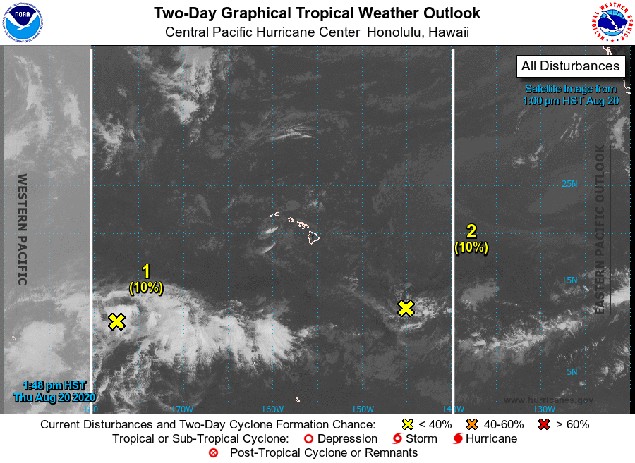
For the central North Pacific...between 140W and 180W:
1. Showers and thunderstorms remain disorganized within an area of
weak low pressure located around 1250 miles southwest of Honolulu,
Hawaii. Environmental conditions are not expected to be conducive
for development in the Central Pacific basin as the system moves
toward the west.
* Formation chance through 48 hours...low...10 percent.
* Formation chance through 5 days...low...10 percent.
2. An area of persistent showers and thunderstorms with a recent flare
up of convective near a center of circulation located 850 miles
southeast of Hilo, Hawaii is forecast to linger in that area for the
next several days. Environmental conditions appear marginally
conducive for development.
* Formation chance through 48 hours...low...10 percent.
* Formation chance through 5 days...low...20 percent.
Elsewhere, no tropical cyclones are expected during the next 5 days.
Forecaster Blood/TS