ZCZC MIATWOAT ALL
TTAA00 KNHC DDHHMM
Tropical Weather Outlook
NWS National Hurricane Center Miami FL
200 AM EDT Tue Aug 11 2020
For the North Atlantic...Caribbean Sea and the Gulf of Mexico:
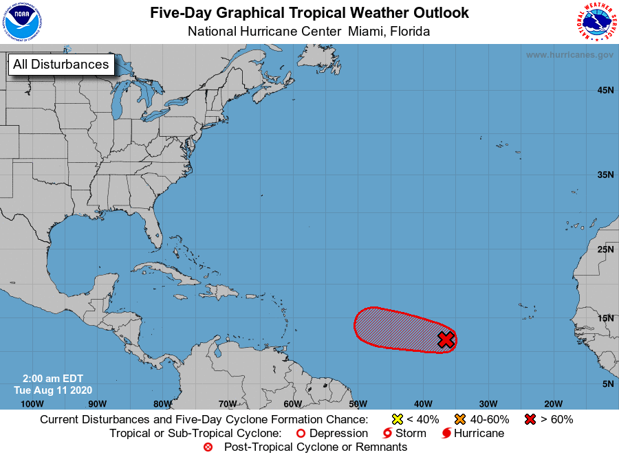
1. Thunderstorm activity associated with a large low pressure system
located more than 800 miles west-southwest of the Cabo Verde Islands
has increased and become a little better organized over the past
several hours. Environmental conditions are expected to be conducive
for development to occur, and a tropical depression is likely to
form during the next day or so while the disturbance moves westward
to west-northwestward at around 15 mph across the tropical Atlantic.
Conditions are forecast to become less conducive for development by
the end of the week.
* Formation chance through 48 hours...high...70 percent.
* Formation chance through 5 days...high...70 percent.
Forecaster Stewart