ZCZC MIATWOAT ALL
TTAA00 KNHC DDHHMM
Tropical Weather Outlook
NWS National Hurricane Center Miami FL
200 AM EDT Mon Aug 10 2020
For the North Atlantic...Caribbean Sea and the Gulf of Mexico:
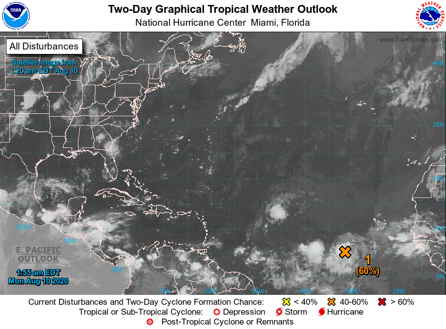
1. Showers and thunderstorms continue to show signs of organization in
association with a vigorous tropical wave located several hundred
miles west-southwest of the Cabo Verde Islands. Environmental
conditions are expected to be somewhat conducive for additional
development to occur, and a tropical depression is likely to form
during the next day or two while the disturbance moves generally
westward at around 15 mph across the tropical Atlantic. Conditions
are forecast to become less conducive for development by the end of
the week.
* Formation chance through 48 hours...medium...60 percent.
* Formation chance through 5 days...medium...60 percent.
Forecaster Stewart