ZCZC MIATWOEP ALL
TTAA00 KNHC DDHHMM
Tropical Weather Outlook
NWS National Hurricane Center Miami FL
500 PM PDT Sat Aug 8 2020
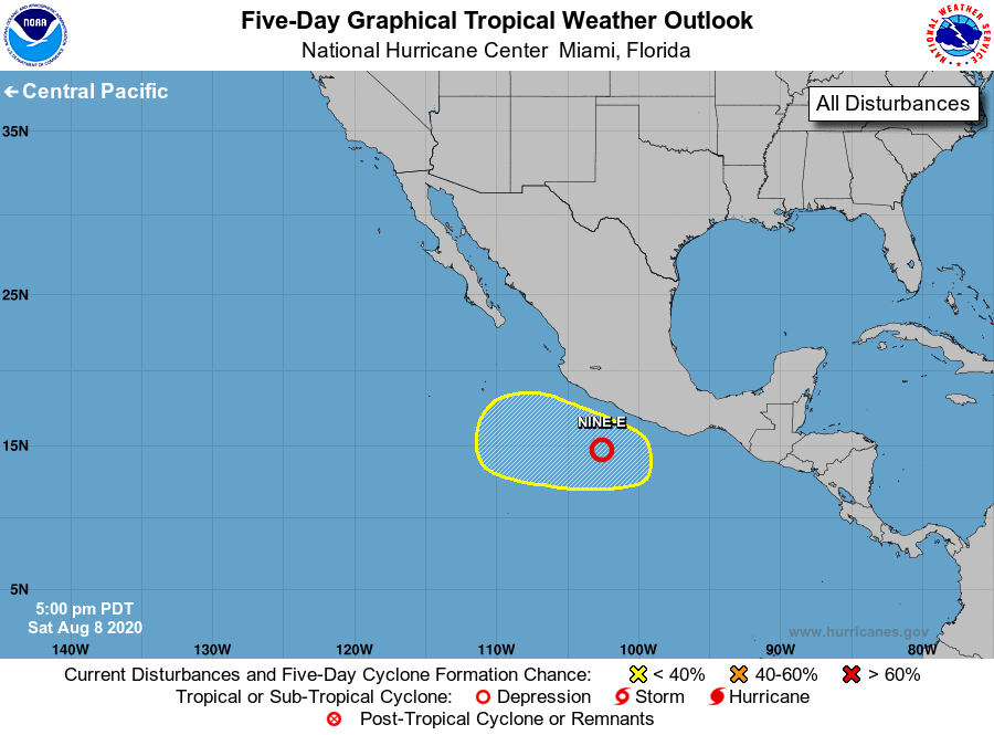
For the eastern North Pacific...east of 140 degrees west longitude:
1. Recent satellite-derived wind data and satellite images indicate
that a tropical depression appears to be forming a couple of
hundred miles southwest of Acapulco, Mexico. If this development
trend continues, advisories will be initiated this evening or
tonight. This system is expected to move west-northwestward over
the next few days, remaining well offshore of the coast of
southwestern Mexico.
* Formation chance through 48 hours...high...90 percent.
* Formation chance through 5 days...high...90 percent.
2. An area of low pressure is expected to form by the middle of
next week offshore of the southwestern coast of Mexico. Some
development is possible thereafter as the system moves
generally west-northwestward.
* Formation chance through 48 hours...low...near 0 percent.
* Formation chance through 5 days...low...near 20 percent.
Forecaster Latto