Skip Navigation Links
NOAA NOAA United States Department of Commerce

NHC Graphical Outlook Archive


« Earliest Available         ‹ Earlier         Later ›         Latest Available »
GIS Shapefiles
Central Pacific Eastern Pacific Atlantic

View 2-Day Graphical Tropical Weather Outlook
Click for Eastern Pacific Click for Eastern Pacific

Tropical Weather Outlook Text

ZCZC MIATWOAT ALL
TTAA00 KNHC DDHHMM

Tropical Weather Outlook
NWS National Hurricane Center Miami FL
200 AM EDT Wed Aug 5 2020

For the North Atlantic...Caribbean Sea and the Gulf of Mexico:

The National Hurricane Center is issuing advisories on Post-Tropical 
Cyclone Isaias, which is moving rapidly north-northeastward over 
eastern Quebec.

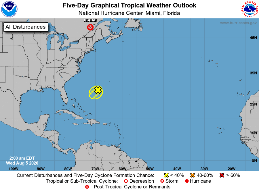
1. A small low pressure area located a few hundred miles southwest of 
Bermuda is producing minimal shower activity.  This low is forecast 
to drift southwestward during the next couple of days, and any 
development is expected to be slow to occur due to dry air and 
increasing upper-level winds.
* Formation chance through 48 hours...low...10 percent.
* Formation chance through 5 days...low...10 percent.

Forecaster Berg


List of Atlantic Outlooks (May 2023 - present)
List of East Pacific Outlooks (May 2023 - present)
List of Central Pacific Outlooks (May 2023 - present)
List of Atlantic Outlooks (July 2014 - April 2023)
List of East Pacific Outlooks (July 2014 - April 2023)
List of Central Pacific Outlooks (June 2019 - April 2023)
List of Atlantic Outlooks (June 2009 - June 2014)
List of East Pacific Outlooks (June 2009 - June 2014)