ZCZC MIATWOAT ALL
TTAA00 KNHC DDHHMM
Tropical Weather Outlook
NWS National Hurricane Center Miami FL
200 AM EDT Thu Jul 30 2020
For the North Atlantic...Caribbean Sea and the Gulf of Mexico:
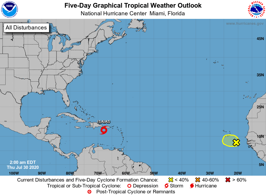
The National Hurricane Center is issuing advisories on recently
upgraded Tropical Storm Isaias, located over the northeastern
Caribbean Sea.
1. A broad area of low pressure, associated with a tropical wave,
located a few hundred miles southeast of the Cabo Verde Islands is
producing disorganized showers and thunderstorms. Some development
of this system is possible during the next day or two before
environmental conditions become unfavorable.
* Formation chance through 48 hours...low...10 percent.
* Formation chance through 5 days...low...10 percent.
Public Advisories on Tropical Storm Isaias are issued under WMO
header WTNT34 KNHC and under AWIPS header MIATCPAT4.
Forecast/Advisories on Tropical Storm Isaias are issued under
WMO header WTNT23 KNHC and under AWIPS header MIATCMAT4.
Forecaster Cangialosi