ZCZC MIATWOEP ALL
TTAA00 KNHC DDHHMM
Tropical Weather Outlook
NWS National Hurricane Center Miami FL
1100 PM PDT Sun Jul 12 2020
For the eastern North Pacific...east of 140 degrees west longitude:
The National Hurricane Center has issued the last advisory on
Post-Tropical Cyclone Cristina, located over 1000 miles west of
the southern tip of the Baja California peninsula.
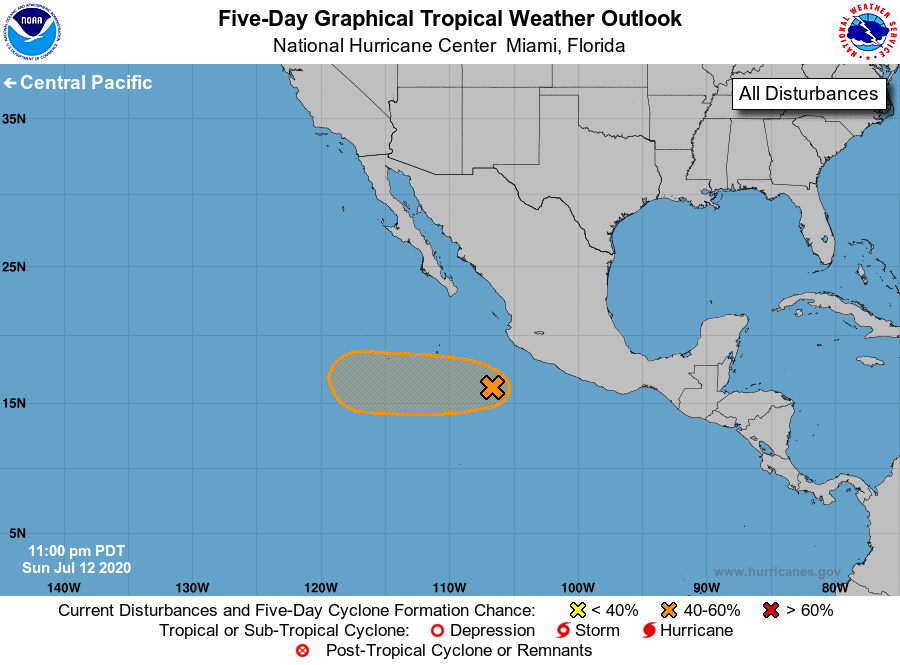
1. Satellite data indicate that a small low pressure area located a
couple of hundred miles southwest of Manzanillo, Mexico, has become
less well defined since yesterday. However, environmental
conditions are still forecast to become more conducive for
development, and this system has the potential to become a tropical
depression during the next couple of days while it moves quickly
west-northwestward to westward, well south of the coast of Mexico.
* Formation chance through 48 hours...medium...60 percent.
* Formation chance through 5 days...medium...60 percent.
Forecaster Blake