ZCZC MIATWOEP ALL
TTAA00 KNHC DDHHMM
Tropical Weather Outlook
NWS National Hurricane Center Miami FL
500 PM PDT Thu Jul 2 2020
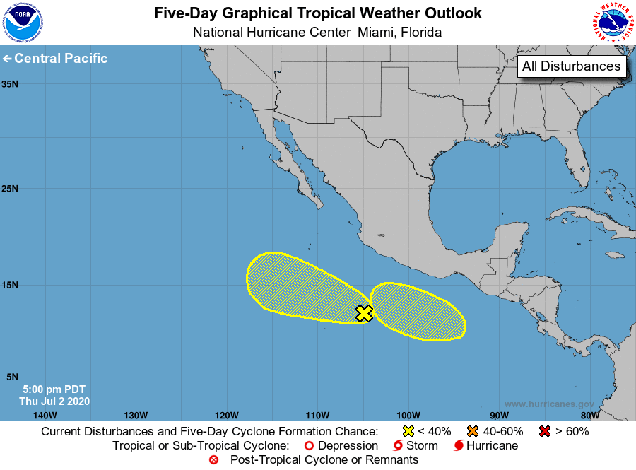
For the eastern North Pacific...east of 140 degrees west longitude:
1. A broad area of low pressure located several hundred miles
south-southwest of Acapulco, Mexico, continues to produce
disorganized showers and thunderstorms. Some gradual
development of this system is possible through early next
week while it moves west-northwestward at around 10 mph.
* Formation chance through 48 hours...low...20 percent.
* Formation chance through 5 days...low...30 percent.
2. An area of low pressure is forecast to form south of the Gulf of
Tehuantepec over the weekend. Environmental conditions are
expected to be conducive for some gradual development of the
system early next week while it moves west-northwestward
well south of the coast of southern Mexico.
* Formation chance through 48 hours...low...near 0 percent.
* Formation chance through 5 days...low...20 percent.
Forecaster Brown