ZCZC MIATWOEP ALL
TTAA00 KNHC DDHHMM
Tropical Weather Outlook
NWS National Hurricane Center Miami FL
1100 PM PDT Sun Jun 28 2020
For the eastern North Pacific...east of 140 degrees west longitude:
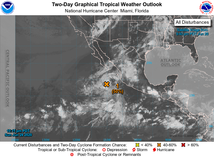
1. Shower activity associated with a trough of low pressure located a
few hundred miles south of the southern tip of the Baja California
peninsula has decreased during the past several hours. The
disturbance is moving northwestward toward colder water, but it
could still briefly become a tropical depression if showers and
thunderstorms redevelop on Monday.
* Formation chance through 48 hours...medium...50 percent.
* Formation chance through 5 days...medium...50 percent.
2. An area of low pressure is forecast to form a few hundred miles
south-southwest of the Gulf of Tehuantepec later this week. Gradual
development of the system will be possible by the weekend while it
moves west-northwestward at 10 to 15 mph well south of Mexico.
* Formation chance through 48 hours...low...near 0 percent.
* Formation chance through 5 days...low...20 percent.
Forecaster Zelinsky