ZCZC MIATWOAT ALL
TTAA00 KNHC DDHHMM
Tropical Weather Outlook
NWS National Hurricane Center Miami FL
800 AM EDT Sun Jun 21 2020
For the North Atlantic...Caribbean Sea and the Gulf of Mexico:
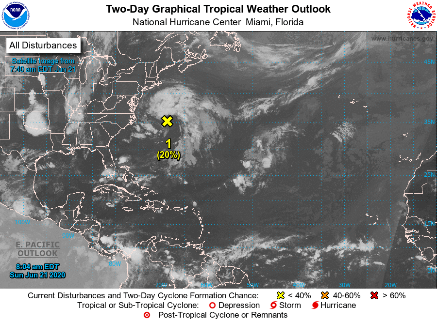
1. A broad, non-tropical low pressure system has formed a few hundred
miles east of the coast of North Carolina. Although cloudiness and
shower activity are currently disorganized, the system could still
briefly acquire some subtropical characteristics tonight and early
Monday while the low moves northeastward over the warm waters of
the Gulfstream. By Monday night and Tuesday, however, the system
is expected to weaken when it moves back over the cooler waters of
the North Atlantic.
* Formation chance through 48 hours...low...20 percent.
* Formation chance through 5 days...low...20 percent.
Forecaster Stewart