ZCZC MIATWOAT ALL
TTAA00 KNHC DDHHMM
Tropical Weather Outlook
NWS National Hurricane Center Miami FL
200 AM EDT Wed Jun 17 2020
For the North Atlantic...Caribbean Sea and the Gulf of Mexico:
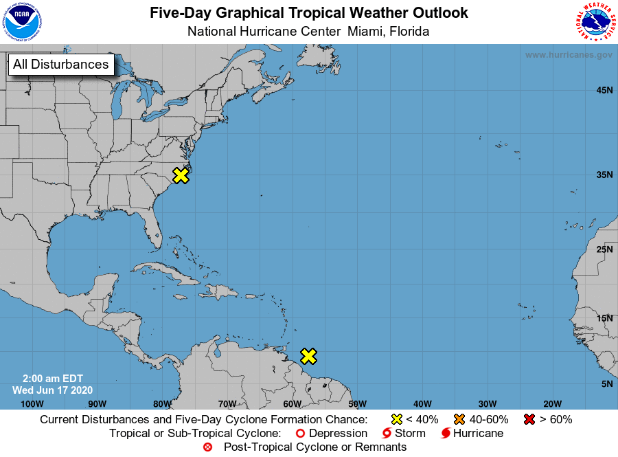
1. A non-tropical low pressure area has moved inland over eastern
North Carolina, and no further development is expected. Heavy
rainfall could still occur over parts of eastern North Carolina and
eastern Virginia through this afternoon. For additional information,
see products from your local National Weather Service office.
* Formation chance through 48 hours...low...near 0 percent.
* Formation chance through 5 days...low...near 0 percent.
2. Showers and thunderstorms have diminished in association with a
tropical wave located a couple of hundred miles east-southeast of
the Windward Islands, and upper-level winds are forecast to be
unfavorable for further development. This system could still
produce gusty winds and heavy rainfall over Trinidad and Tobago and
northeastern coastal sections of Venezuela during the next day or
so.
* Formation chance through 48 hours...low...near 0 percent.
* Formation chance through 5 days...low...near 0 percent.
Forecaster Blake