ZCZC MIATWOAT ALL
TTAA00 KNHC DDHHMM
Special Tropical Weather Outlook
NWS National Hurricane Center Miami FL
250 PM EDT Sat May 30 2020
For the North Atlantic...Caribbean Sea and the Gulf of Mexico:
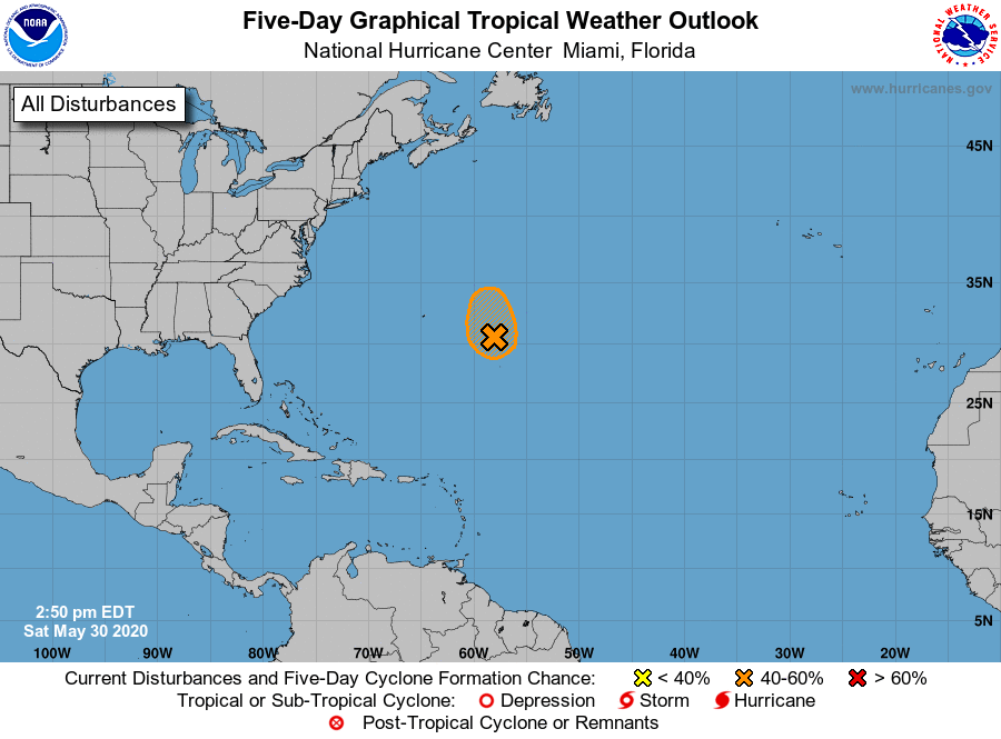
Special Tropical Weather Outlook issued to discuss the area of low
pressure over the central Atlantic.
1. Shower activity has decreased today in association with a broad area
of low pressure located about 400 miles east-southeast of Bermuda.
Some development of this system is still possible through tonight,
and it could become a short-lived subtropical depression while it
moves northwestward over the central Atlantic. After that time,
further development is not anticipated due to unfavorable
environmental conditions. The next Special Tropical Weather Outlook
will be issued by 9 PM EDT today, or earlier if necessary.
* Formation chance through 48 hours...medium...40 percent.
* Formation chance through 5 days...medium...40 percent.
Forecaster Latto