ZCZC MIATWOEP ALL
TTAA00 KNHC DDHHMM
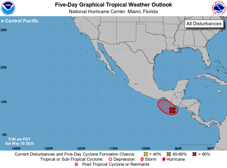
Tropical Weather Outlook
NWS National Hurricane Center Miami FL
500 AM PDT Sat May 30 2020
For the eastern North Pacific...east of 140 degrees west longitude:
Showers and thunderstorms continue to gradually become better
organized in association with an area of low pressure located just
off the coasts of Guatemala and El Salvador. Additional slow
development of this system is possible, and it could still become a
tropical depression during the next couple of days if it remains
offshore.
1. Regardless of development, this slow moving system is expected to
produce heavy rainfall over portions of Central America and southern
Mexico through early next week. These rains could cause
life-threatening flash floods and mudslides, especially in areas of
mountainous terrain. See products from your local meteorological
service for additional information.
* Formation chance through 48 hours...medium...60 percent.
* Formation chance through 5 days...high...70 percent.
Forecaster Cangialosi