Skip Navigation Links
NOAA NOAA United States Department of Commerce

NHC Graphical Outlook Archive


« Earliest Available         ‹ Earlier         Later ›         Latest Available »
GIS Shapefiles
Central Pacific Eastern Pacific Atlantic

View 2-Day Graphical Tropical Weather Outlook
Click for Eastern North Pacific Click for Eastern North Pacific

Tropical Weather Outlook Text

ZCZC HFOTWOCP ALL
TTAA00 PHFO DDHHMM

Tropical Weather Outlook
NWS Central Pacific Hurricane Center Honolulu HI
800 AM HST Sat Oct 19 2019

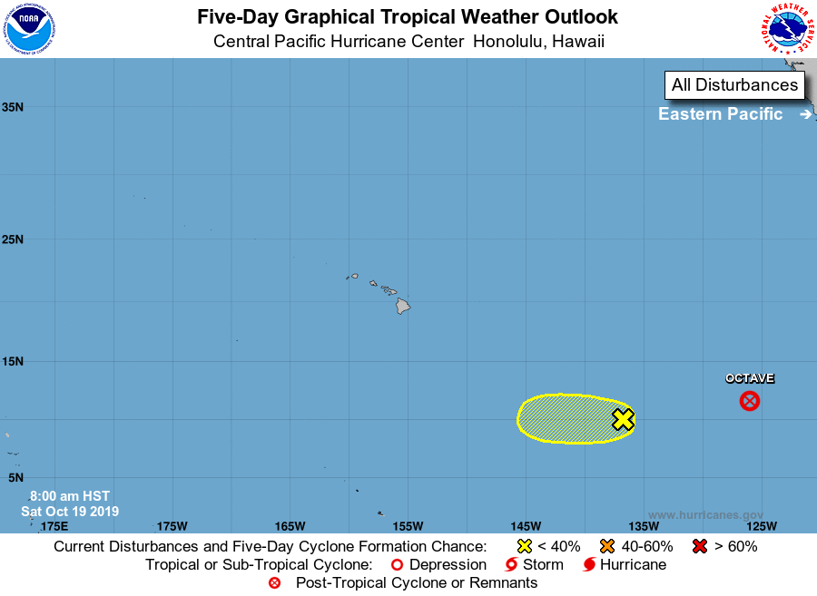
For the central North Pacific...between 140W and 180W:

1. Showers and thunderstorms have increased near a small low pressure
system located over the far southwestern portion of the eastern
Pacific basin. However, any further development is expected to be
slow to occur while the system drifts slowly westward at about 5
mph. This system is expected to move into the central Pacific basin
by late Sunday.
* Formation chance through 48 hours...low...20 percent.
* Formation chance through 5 days...low...20 percent.

Elsewhere, no tropical cyclones are expected during the next 5 days.

Forecaster TS


List of Atlantic Outlooks (May 2023 - present)
List of East Pacific Outlooks (May 2023 - present)
List of Central Pacific Outlooks (May 2023 - present)
List of Atlantic Outlooks (July 2014 - April 2023)
List of East Pacific Outlooks (July 2014 - April 2023)
List of Central Pacific Outlooks (June 2019 - April 2023)
List of Atlantic Outlooks (June 2009 - June 2014)
List of East Pacific Outlooks (June 2009 - June 2014)