ZCZC MIATWOEP ALL
TTAA00 KNHC DDHHMM
Tropical Weather Outlook
NWS National Hurricane Center Miami FL
500 PM PDT Sun Oct 13 2019
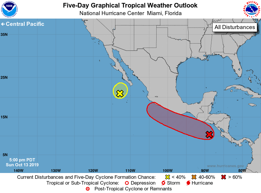
For the eastern North Pacific...east of 140 degrees west longitude:
1. An area of low pressure located a couple of hundred miles southwest
of the southern tip of the Baja California peninsula remains broad
and elongated without a well-defined center, according to recent
satellite-derived wind data. Upper-level winds are increasing over
this system, and the chances for significant development continue
to decrease as the low moves slowly north-northeastward.
Regardless of development, this system is expected to produce heavy
rainfall across portions of Baja California Sur, southern Sonora,
and northern Sinaloa through Monday.
* Formation chance through 48 hours...low...30 percent.
* Formation chance through 5 days...low...30 percent.
2. A broad area of low pressure located a few hundred miles west of
the coasts of Nicaragua and Costa Rica is producing disorganized
showers and thunderstorms. Gradual development is expected over the
next several days, and a tropical depression is likely to form later
this week while the system moves west-northwestward at about 10 mph
near or just offshore the coast of Mexico.
* Formation chance through 48 hours...low...30 percent.
* Formation chance through 5 days...high...70 percent.
Forecaster Berg