ZCZC MIATWOEP ALL
TTAA00 KNHC DDHHMM
Tropical Weather Outlook
NWS National Hurricane Center Miami FL
1100 AM PDT Fri Oct 11 2019
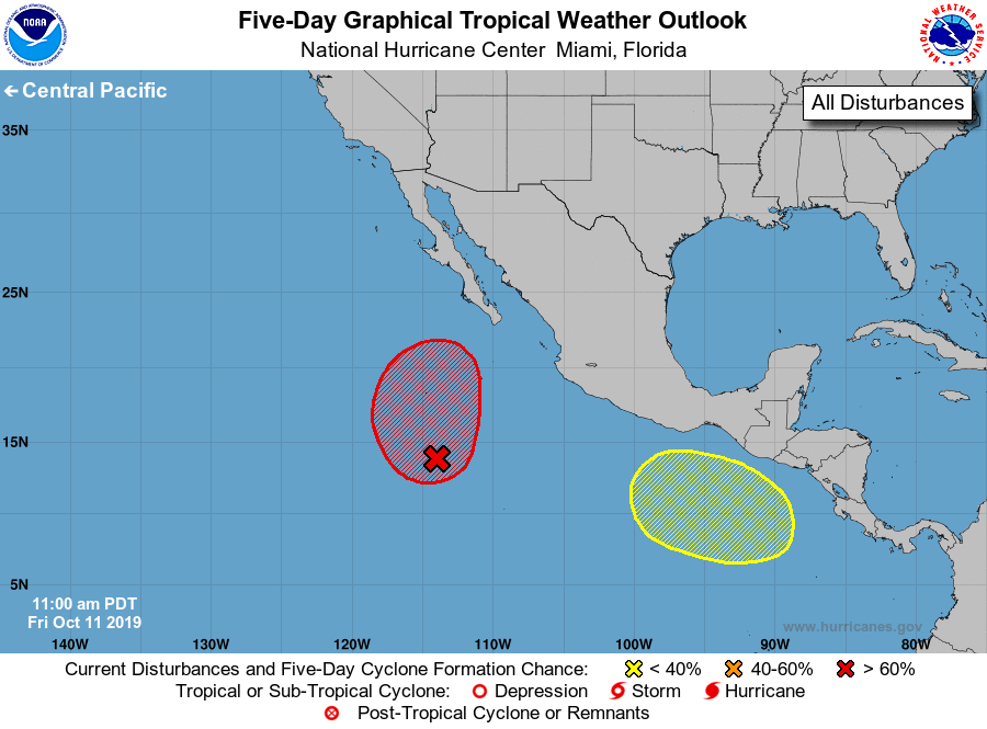
For the eastern North Pacific...east of 140 degrees west longitude:
1. An elongated trough of low pressure located several hundred miles
south-southwest of the southern tip of the Baja California peninsula
continues to produce a large area of disorganized showers and
thunderstorms. Environmental conditions are conducive for
development of this system, and a tropical depression is expected to
form over the weekend while the system moves northwestward and then
northward at 5 to 10 mph. Conditions will become less conducive
for additional development early next week when the system begins to
encounter colder waters and stronger upper-level winds.
* Formation chance through 48 hours...high...80 percent.
* Formation chance through 5 days...high...90 percent.
2. A broad area of low pressure is forecast to form over the eastern
Pacific south of the coast of southeastern Mexico early next week.
Some gradual development of this system is possible after that time
while it moves west-northwestward.
* Formation chance through 48 hours...low...near 0 percent.
* Formation chance through 5 days...low...20 percent.
Forecaster Brown