ZCZC MIATWOEP ALL
TTAA00 KNHC DDHHMM
Tropical Weather Outlook
NWS National Hurricane Center Miami FL
500 AM PDT Sat Oct 5 2019
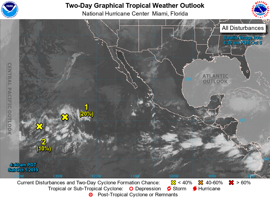
For the eastern North Pacific...east of 140 degrees west longitude:
1. Showers and thunderstorms associated with an area of low pressure
located about 1300 miles west-southwest of the southern tip of the
Baja California peninsula have not increased in organization during
the past day or so. This system is expected to interact and
possibly merge with another disturbance to its southwest over the
next couple of days, and the likelihood of development appears to
be decreasing. The low is forecast to move northwestward at about
10 mph during the next couple of days.
* Formation chance through 48 hours...low...20 percent.
* Formation chance through 5 days...low...20 percent.
2. A nearly stationary area of low pressure, located just west of the
disturbance mentioned above about 1700 miles southwest of the
southern tip of the Baja California peninsula, continues to produce
disorganized shower and thunderstorm activity, which has been
decreasing over the past several hours. Development of this
system is not likely before it interacts or merges with the larger
disturbance located to its northeast late this weekend or early next
week.
* Formation chance through 48 hours...low...10 percent.
* Formation chance through 5 days...low...10 percent.
Forecaster Berg