ZCZC MIATWOEP ALL
TTAA00 KNHC DDHHMM
Tropical Weather Outlook
NWS National Hurricane Center Miami FL
1100 PM PDT Thu Sep 19 2019
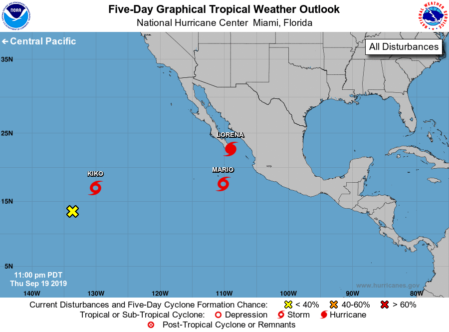
For the eastern North Pacific...east of 140 degrees west longitude:
The National Hurricane Center is issuing advisories on Tropical
Storm Kiko, located over the far southwestern part of the basin, on
Tropical Storm Mario, located a few hundred miles south of the
southern tip of the Baja California peninsula, and on Tropical Storm
Lorena, located near the Islas Marias.
1. Shower activity is currently limited in association with a weak area
of low pressure located about 1500 miles east-southeast of the Big
Island of Hawaii. This system is expected to move northeastward and
merge with Kiko this weekend and development is not anticipated.
* Formation chance through 48 hours...low...near 0 percent.
* Formation chance through 5 days...low...near 0 percent.
Forecaster Cangialosi