ZCZC MIATWOEP ALL
TTAA00 KNHC DDHHMM
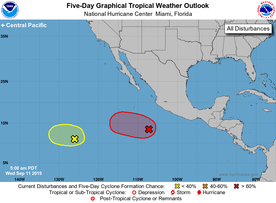
Tropical Weather Outlook
NWS National Hurricane Center Miami FL
500 AM PDT Wed Sep 11 2019
For the eastern North Pacific...east of 140 degrees west longitude:
1. A broad area of low pressure located several hundred miles
west-southwest of Acapulco, Mexico, is gradually becoming better
defined. Environmental conditions are conducive for further
development of this disturbance, and a tropical depression is likely
to form within the next couple of days while the low moves westward
to west-northwestward at 10 to 15 mph.
* Formation chance through 48 hours...high...80 percent.
* Formation chance through 5 days...high...90 percent.
2. An area of low pressure is expected to form more than 1000 miles to
the southwest of the southern tip of the Baja California Peninsula
during the next couple of days. Some additional development is
possible while the system moves slowly westward through the
weekend and early next week.
* Formation chance through 48 hours...low...near 10 percent.
* Formation chance through 5 days...low...30 percent.
Forecaster Latto