ZCZC MIATWOEP ALL
TTAA00 KNHC DDHHMM
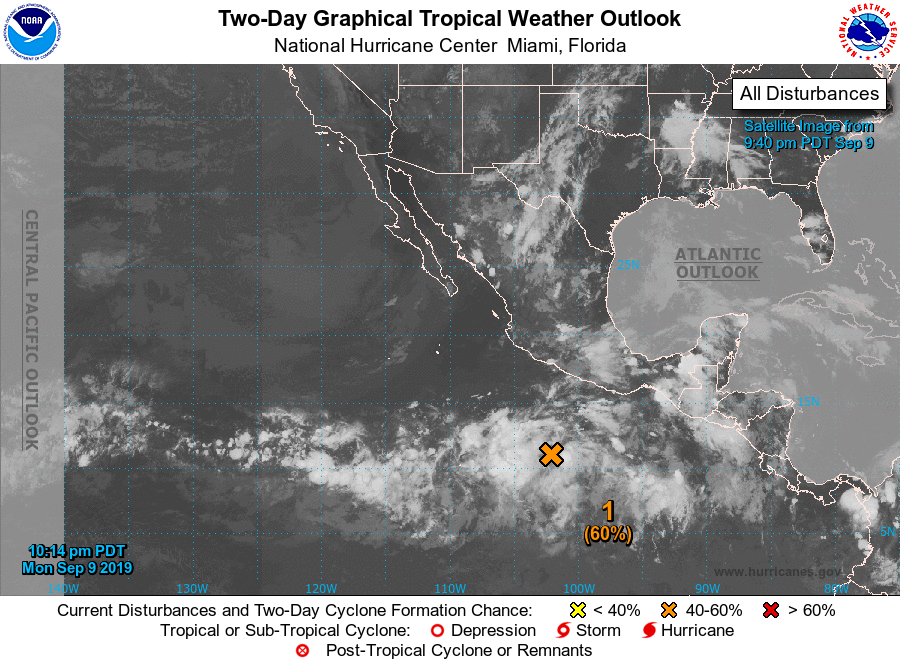
Tropical Weather Outlook
NWS National Hurricane Center Miami FL
1100 PM PDT Mon Sep 9 2019
For the eastern North Pacific...east of 140 degrees west longitude:
1. A broad area of low pressure located several hundred miles
southwest of Acapulco, Mexico, is producing a large area of
disorganized showers and thunderstorms. Environmental conditions
are expected to be conducive for development, and a tropical
depression is likely to form within the next few days while the
system moves west-northwestward at 10 to 15 mph.
* Formation chance through 48 hours...medium...60 percent.
* Formation chance through 5 days...high...90 percent.
2. An area of low pressure is expected to form more than 1000 miles to
the southwest of the southern tip of the Baja California Peninsula
by late this week. Some additional slow development is possible as
the system moves slowly westward.
* Formation chance through 48 hours...low...near 0 percent.
* Formation chance through 5 days...low...20 percent.
Forecaster Brown