ZCZC MIATWOEP ALL
TTAA00 KNHC DDHHMM
Tropical Weather Outlook
NWS National Hurricane Center Miami FL
1100 PM PDT Tue Aug 20 2019
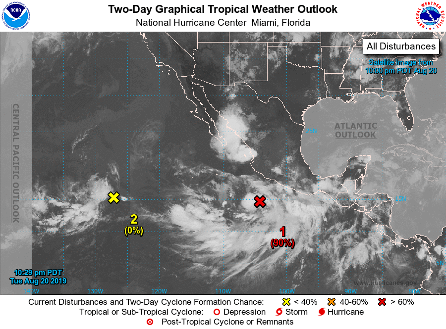
For the eastern North Pacific...east of 140 degrees west longitude:
1. Showers and thunderstorms associated with a large low pressure
system located a couple of hundred miles south of the southern coast
of Mexico continue to show signs of becoming better organized.
Additional development is anticipated and a tropical depression is
likely to form during the next day or so while the system moves
west-northwestward at 10 to 15 mph, parallel to and just offshore of
the coast of Mexico. This system could produce locally heavy
rainfall along portions of the coast of southern Mexico during the
next day or two. Additional information on this system can be found
in High Seas Forecasts issued by the National Weather Service.
* Formation chance through 48 hours...high...90 percent.
* Formation chance through 5 days...high...90 percent.
2. An area of disturbed weather is located over the western portion of
the eastern North Pacific. Any development of this system will
likely be slow to occur while it moves generally westward for the
next several days.
* Formation chance through 48 hours...low...near 0 percent.
* Formation chance through 5 days...low...30 percent.
High Seas Forecasts issued by the National Weather Service
can be found under AWIPS header NFDHSFEPI, WMO header FZPN02
KWBC, and on the web at ocean.weather.gov/shtml/NFDHSFEPI.php
Forecaster Zelinsky