ZCZC MIATWOEP ALL
TTAA00 KNHC DDHHMM
Tropical Weather Outlook
NWS National Hurricane Center Miami FL
1100 PM PDT Wed Aug 14 2019
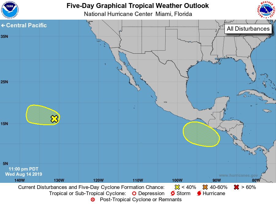
For the eastern North Pacific...east of 140 degrees west longitude:
1. An elongated area of low pressure is producing limited shower
activity. Only slight development of this disturbance, if any, is
expected during the next couple of days while it moves westward at
10 to 15 mph. Environmental conditions are forecast to become
unfavorable for further development by the weekend.
* Formation chance through 48 hours...low...20 percent.
* Formation chance through 5 days...low...20 percent.
2. An area of low pressure is forecast to form south or southeast of
the southeastern coast of Mexico over the weekend. Environmental
conditions are expected to be conducive for gradual development
thereafter while the system moves generally westward through early
next week.
* Formation chance through 48 hours...low...near 0 percent.
* Formation chance through 5 days...low...30 percent.
Forecaster Zelinsky